My nephew, Ron, accompanied me to Kanturayan
falls. Kanturayan is a sitio in barangay Yapo which is in the border of
the town of Bugasong, Antique. He had been there five years ago and
for some time, I showed my interest to visit the falls.
My nephew, Ron, accompanied me to Kanturayan
falls. Kanturayan is a sitio in barangay Yapo which is in the border of
the town of Bugasong, Antique. He had been there five years ago and
for some time, I showed my interest to visit the falls.
There are motorcycles in the marketplace of the town of Bugasong
and the fare per head is 25 pesos. The travel time is under 30
minutes and the unloading area would be at barangay Yapo
itself. From there, you have to walk in order to reach the falls. Anyway,
since there was no motorcycle that time, we took a tricycle ride going to
Tagudtod Norte which happens to be the final unloading area of the
tricycle. The cost of the ride per head is 20 pesos. From
there, a motorcycle ride to barangay Yapo would be 10 pesos. But
that time, there was no motorcycle either so we decided to walk.
 As of this writing, the road from Tagudtod Norte to barangay
Yapo is under construction. Along the way, there are some parts of the
road that are already concrete and maybe by next year, the whole stretch of the
road will be totally cemented.
As of this writing, the road from Tagudtod Norte to barangay
Yapo is under construction. Along the way, there are some parts of the
road that are already concrete and maybe by next year, the whole stretch of the
road will be totally cemented.
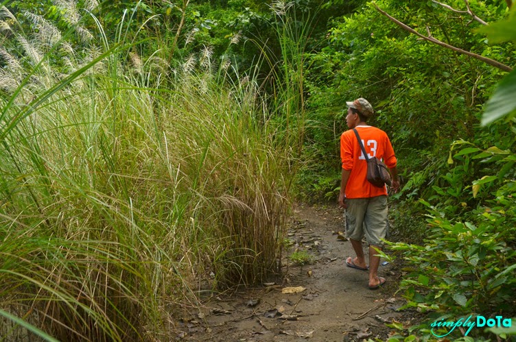
We hardly noticed of the time since we stopped from time to time
to take some pictures. It took us under an hour to reach barangay
Yapo. Along the way, there are several sitios that we passed and
people in those areas are generally friendly. Visitors to this place
will not get lost since there is only one major road to follow until reaching
barangay Yapo which is the end of the road.
The moment we started
our walk from Tagudtod Norte, the mountains immediately greeted us which is a
total refreshing sight. Several meters afterwards, the long stretch
of the river approaching the dam can be seen from the road. As we
followed the road to barangay Yapo, the river becomes our guide. At
some point tough, we reached a part where the river is momentarily out of sight
but the mountains oversee our journey. As we come closer to our
destination, the mountains likewise seem an arm stretch away.
 After some time, the river comes into a full view
again. That was the time when we were already at the foot of the
mountain. The road had been widened where a large truck can pass along, a
total relief to the commuters who used to fear more than a meter wide trail
before.
After some time, the river comes into a full view
again. That was the time when we were already at the foot of the
mountain. The road had been widened where a large truck can pass along, a
total relief to the commuters who used to fear more than a meter wide trail
before.
When we reached the end of the road at barangay Yapo, we took the concrete steps leading toward the river. The river is several meters wide and at that particular time where it rained hard a couple of days before, the water was discolored. As we walked beside the river, we can tell that there are some shallow and deep parts. And it is hard to determine how really deep is the deepest part.
We stayed mostly on the trail beside the river. My nephew has still a good recollection of the path and I just followed him, pausing from time to time to take some pictures. It was already high noon and the view was perfect. There were cloud formations, the mountains are pristine, there’s the presence of water, and all I need to do was to have a good composition.
 There were some parts of the trail that we had to crawl within
the bushes and under a fallen tree. I guess those paths are seldom
used because they are hard to notice. Since the water level was
normal after the flood, we had the opportunity to walk on the shoreline. The
rest of the trail is right within the backyard of a particular family and I
guess they are used to people passing along. And after almost a
30-minute hike, we landed on the other part of the river where we had to find a
way to cross the river.
There were some parts of the trail that we had to crawl within
the bushes and under a fallen tree. I guess those paths are seldom
used because they are hard to notice. Since the water level was
normal after the flood, we had the opportunity to walk on the shoreline. The
rest of the trail is right within the backyard of a particular family and I
guess they are used to people passing along. And after almost a
30-minute hike, we landed on the other part of the river where we had to find a
way to cross the river.
Since we were new to the place and there is no hanging bridge nor a particular river crossing, we were trying to find out which part of the river is passable. There were no people passing that time and the only way to determine if it was passable was to cross it.
We readied our bags and walked barefoot on the river. The sharp stones were agonizing experience for our feet and they slowed us down. Ron walked ahead of me and testing the depth of the river. Since the current was strong and the river was deep, the idea was to go upstream and slowly walked downstream until we cross the river. As I followed him, I could feel that little by little as the water level rose, the current became stronger. It was hard to set your foot firmly on the river bed because the stones are sharp and at the same time, the sand and the stones are washed away by the current. There was a particular point when I got scared and almost carried by the strong current. The water was already waist deep and as we stepped further, the level grew higher and the current grew stronger. Since I don’t know how to swim and given the strong current, I told Ron to abandon the idea. I felt relieved when we were already on the dry land.
 I thought it would be a good day to explore the countryside
because the sun was shining brightly. Though the storm had already
passed and the weather was great, we never had a slightest idea that our trip
almost turned into a disaster. I already gave up the idea of going
to the falls even though the falls is already visible to where we were standing
that time. I value our life more than anything else and even if it
will be an epic fail in the making, I don’t mind at all. We can always
return and the best time to be here will be during the summer season where the
river is only knee deep. But Ron did not gave up that easy.
I thought it would be a good day to explore the countryside
because the sun was shining brightly. Though the storm had already
passed and the weather was great, we never had a slightest idea that our trip
almost turned into a disaster. I already gave up the idea of going
to the falls even though the falls is already visible to where we were standing
that time. I value our life more than anything else and even if it
will be an epic fail in the making, I don’t mind at all. We can always
return and the best time to be here will be during the summer season where the
river is only knee deep. But Ron did not gave up that easy.
After some time, the river comes into a full view
again. That was the time when we were already at the foot of the
mountain. The road had been widened where a large truck can pass along, a
total relief to the commuters who used to fear more than a meter wide trail
before. When we reached the end of the road at barangay Yapo, we took the concrete steps leading toward the river. The river is several meters wide and at that particular time where it rained hard a couple of days before, the water was discolored. As we walked beside the river, we can tell that there are some shallow and deep parts. And it is hard to determine how really deep is the deepest part.
We stayed mostly on the trail beside the river. My nephew has still a good recollection of the path and I just followed him, pausing from time to time to take some pictures. It was already high noon and the view was perfect. There were cloud formations, the mountains are pristine, there’s the presence of water, and all I need to do was to have a good composition.
There were some parts of the trail that we had to crawl within
the bushes and under a fallen tree. I guess those paths are seldom
used because they are hard to notice. Since the water level was
normal after the flood, we had the opportunity to walk on the shoreline. The
rest of the trail is right within the backyard of a particular family and I
guess they are used to people passing along. And after almost a
30-minute hike, we landed on the other part of the river where we had to find a
way to cross the river.Since we were new to the place and there is no hanging bridge nor a particular river crossing, we were trying to find out which part of the river is passable. There were no people passing that time and the only way to determine if it was passable was to cross it.
We readied our bags and walked barefoot on the river. The sharp stones were agonizing experience for our feet and they slowed us down. Ron walked ahead of me and testing the depth of the river. Since the current was strong and the river was deep, the idea was to go upstream and slowly walked downstream until we cross the river. As I followed him, I could feel that little by little as the water level rose, the current became stronger. It was hard to set your foot firmly on the river bed because the stones are sharp and at the same time, the sand and the stones are washed away by the current. There was a particular point when I got scared and almost carried by the strong current. The water was already waist deep and as we stepped further, the level grew higher and the current grew stronger. Since I don’t know how to swim and given the strong current, I told Ron to abandon the idea. I felt relieved when we were already on the dry land.